Regular price
R 6,795.00 ZAR
Sale price
R 5,995.00 ZAR
Unit price/ per
Sale
Sold out
Taxes included.
Couldn't load pickup availability
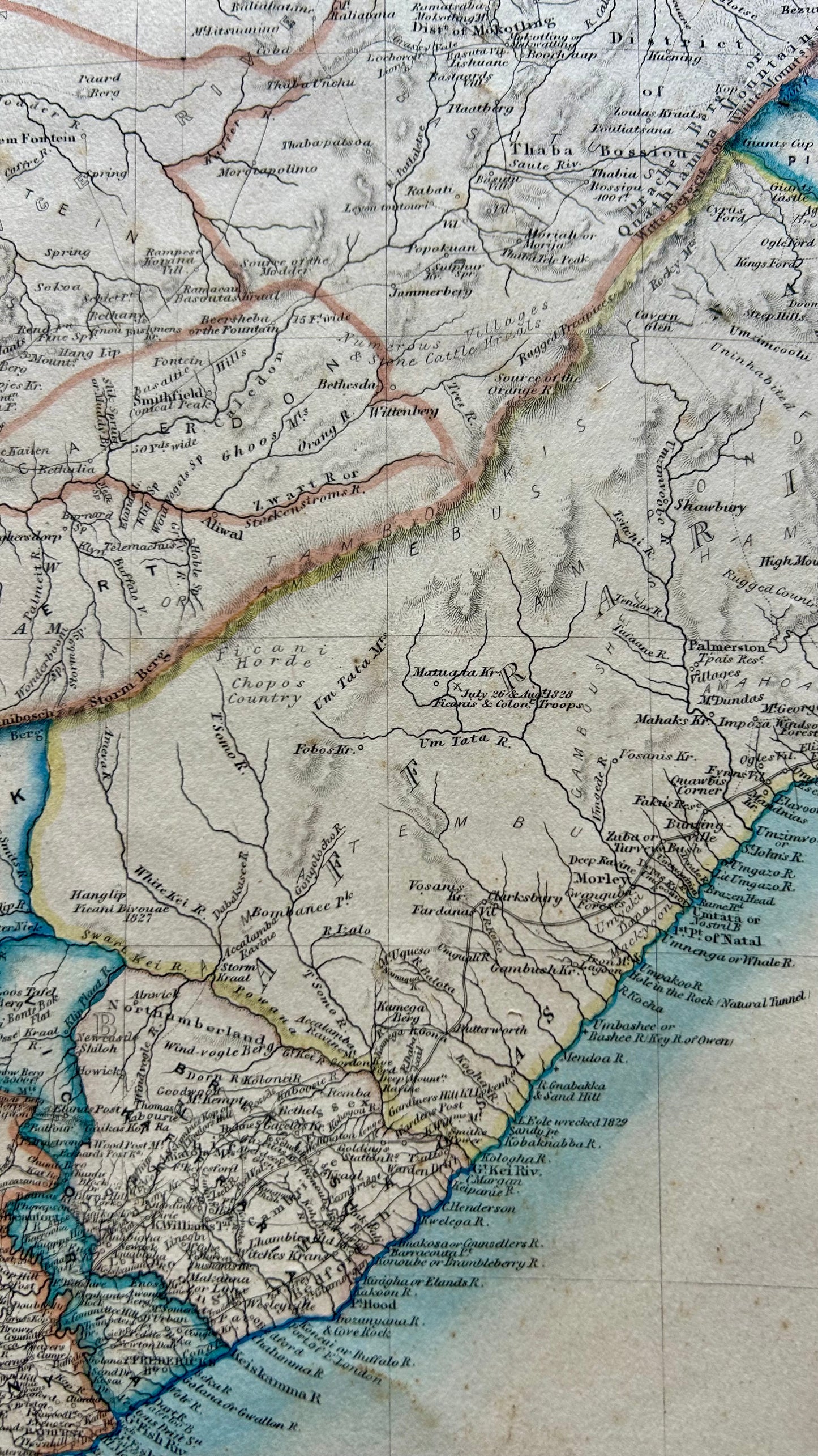
The map titled "South Africa" was created by James Wyld, Geographer to the Queen and H R H Prince Albert, Charing Cross, East London Plate Size: 53cm x 84cm James Wyld’s 1844 map of South Africa. The British mapmaker James Wyld was one of the foremost cartographers of the 19th century and his map of South Africa of which six subsequent editions were published provided a relatively accurate picture of geographical knowledge at the time. Although some of these maps are undated, it can be inferred from information on them that the second edition must have been published pre-1848 and the third post-1854