1
/
of
2
Barter Buy Antiques
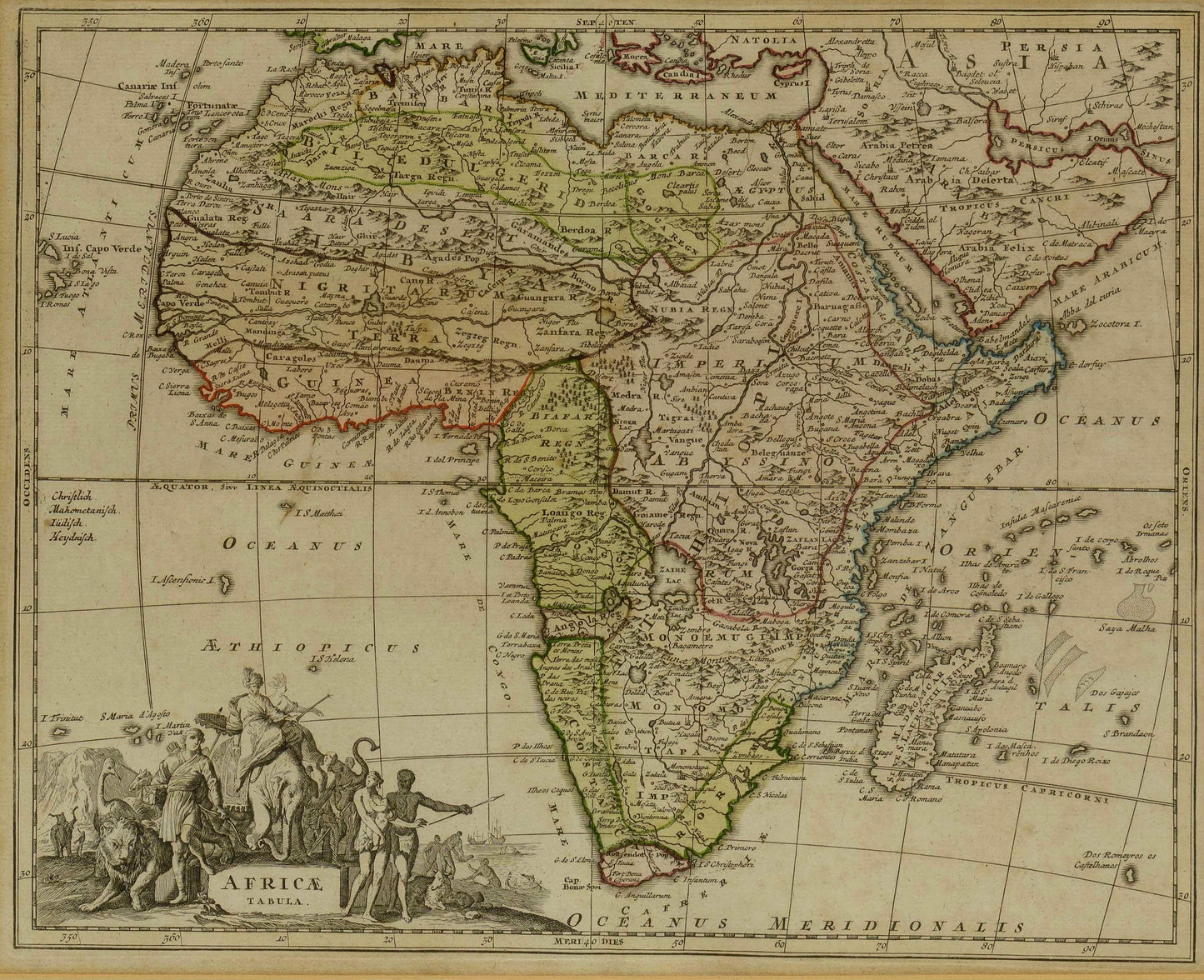
AFRICAE TABULA - MAP OF AFRICA - Christoph Weigel (1654 - 1725)
AFRICAE TABULA - MAP OF AFRICA - Christoph Weigel (1654 - 1725)
Regular price
R 6,995.00 ZAR
Regular price
R 7,995.00 ZAR
Sale price
R 6,995.00 ZAR
Unit price
/
per
Taxes included.
Couldn't load pickup availability
Old coloured map of the African continent. Printed in Nuremberg by Johann Ernst Adelbulner in 1718
Size: 27.6cm x 34.2 cm
Antique map of Africa by Christoph Weigel. Parts of the geographic information are already shown accurately, others are still based on the Ptolemaic maps, such as the source of the Nile in the Lakes Zaire and Zaflan. From Bequemer Schul- und Reisen-Atlas also titled Atlas scholasticus et itinerarius by Christoph Weigel. Weigel's well-known travel atlas, which he published in collaboration with Professor Johann David Köhler.
Share